Six weeks in the D’Entrecasteaux Channel

The plan was Bruny on the Monday with the northerly, up the Derwent on the Tuesday with a westerly for a broad reach, then a couple of nights in the marina at Prince of Wales Bay.

Maria asked whether I was only staying in the marina two nights. I said “no plans atm. I can stay longer in the D’Entrecasteaux area. I still have weeks of food and enough clean undies. There’s amazing anchorages there.”

Six weeks.

Sunday 5 April: into the Channel

Weighed at Lime Bay at 06:51. Foggy first thing, then it cleared. A damn fine day for a little yachting holiday.

Sailed where I could, motored where I could not. Dropped the main in light winds for a change, in one clean swoop straight into the bag.

I looked into a couple of bays at the top of Bruny before I settled. Plenty of room in the first one, but I did not like the shape of the valley behind it. Me thinks bullets.

Then round into the Duck Pond, and it was empty.

35m of chain in 5m of water. It set solid first time and I dug it in with a fair bit of power. Then bacon and eggs.
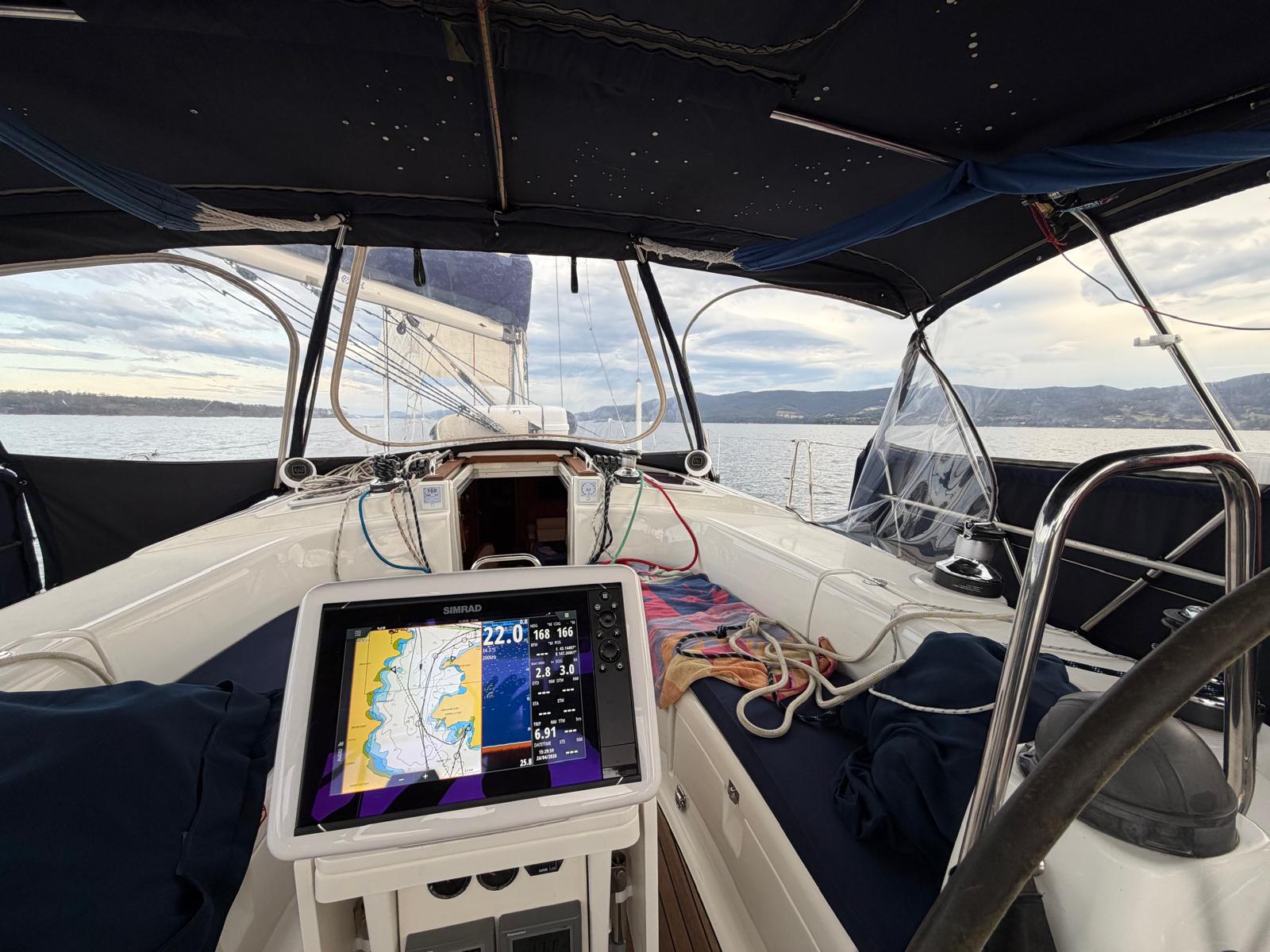
Three knots over the ground, going nowhere in particular.

What a perfect spot. This is the bee’s knees. You could sit out a full gale from any wind direction in there. I thought at the time I might have to stay the week.

Only 1 bar of Optus. Putting the aerial in the external housing gives 2 bars but only 248kbps, so the BBC website takes about a minute to load. The Starlink works fine but I have to manage the batteries. It is workable.

I stayed eight nights.

The weather

The barometer sat at 1031 the day I came in, fell to 1004 by the middle of April and climbed to a little over 1038 by the second week of May, where it stayed.

Settled weather in the Channel is not the same as settled weather anywhere else, because the hills get a vote.

On the tenth there was literally no wind, then it gusted 25 knots and more. Real bullets, williwaws. I could see the boats over in Barnes Bay pointing west to a westerly while I was still pointing north, because there is a big hill to the west and the wind comes down it and along the water. A bit like Fourni.

Observations that afternoon had 32 knots at Opossum Bay and 30 at Launceston Airport. Further south it was 35kt at Maatsuyker Island and 39kt at Low Rocky Point. A week later Mount Wellington averaged 43.

I spent that morning messing about with the snubber and the chain, because it had been noisy in the V-berth overnight. It would be easier to sleep in the aft cabin, but I worry I would not wake up if I needed to. Slept from 10 to 1:30, awake till 4, then slept till 7:30.

Re-anchored the following morning, much better location, very sheltered from the westerlies.

Cold

Around the twelfth it got down to 3 degrees and stayed low for most of a week.

Very quiet in the mornings, and bloody cold. I stayed inside and coded. I went outside for 5 minutes and gave up. Everything closed, all the internal doors shut to keep what warmth there was in the saloon, and not very successfully.

Sitting still with bare hands does not help. Sailing gloves would annoy me, so I cut the fingers off something instead.
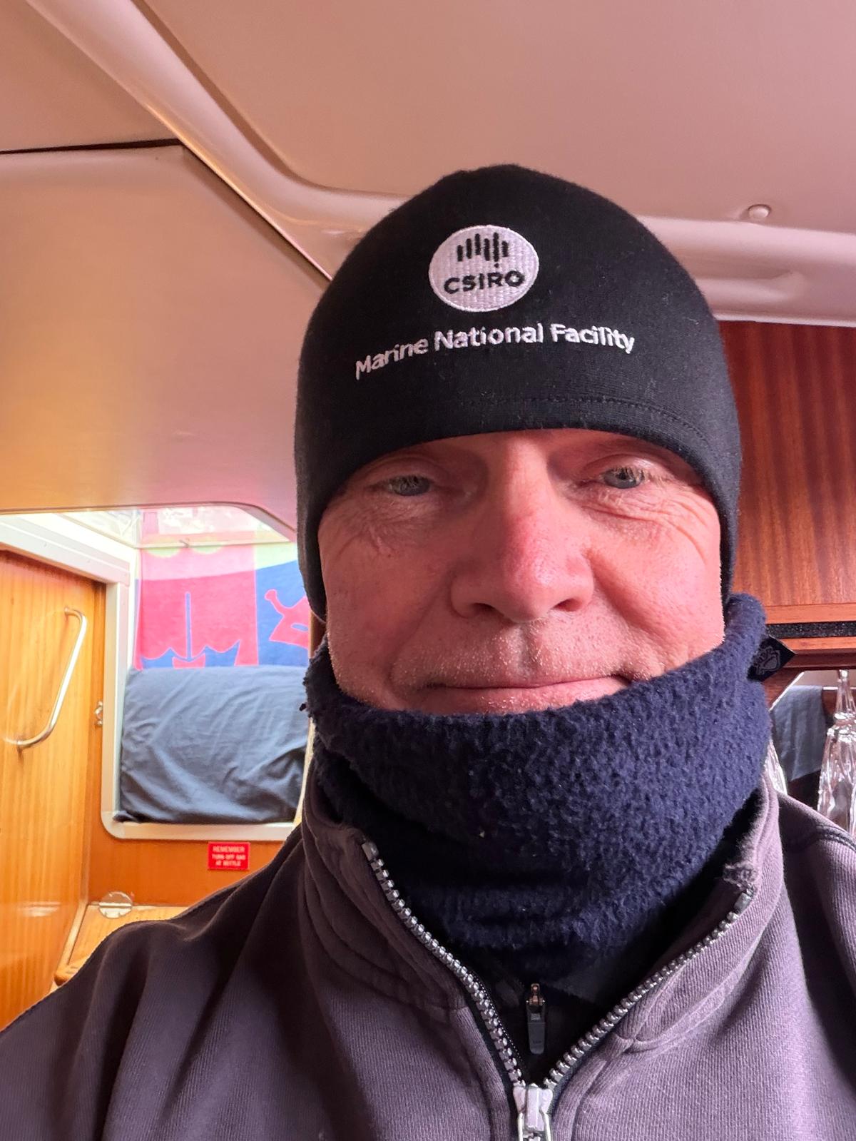
Interim workaround.
Interim workaround.

The instruments

Most days I was working. Sunny Spells is the test platform for SCADYS, and the two things on trial were the MDD400 and the WTI400.

The MDD400 is a data display that takes NMEA 2000 and legacy serial and puts it where you can read it. The WTI400 sits between an old analogue masthead unit and the network. That solves a problem a lot of older boats have. The sensor at the masthead still works, the display at the bottom died ten years ago, and the manufacturer stopped caring ten years before that. Climb the mast and spend a thousand dollars, or keep the sensor and replace everything under it.

On my second morning in the Channel I sent Maria four words. The wind instrument is doing very well.
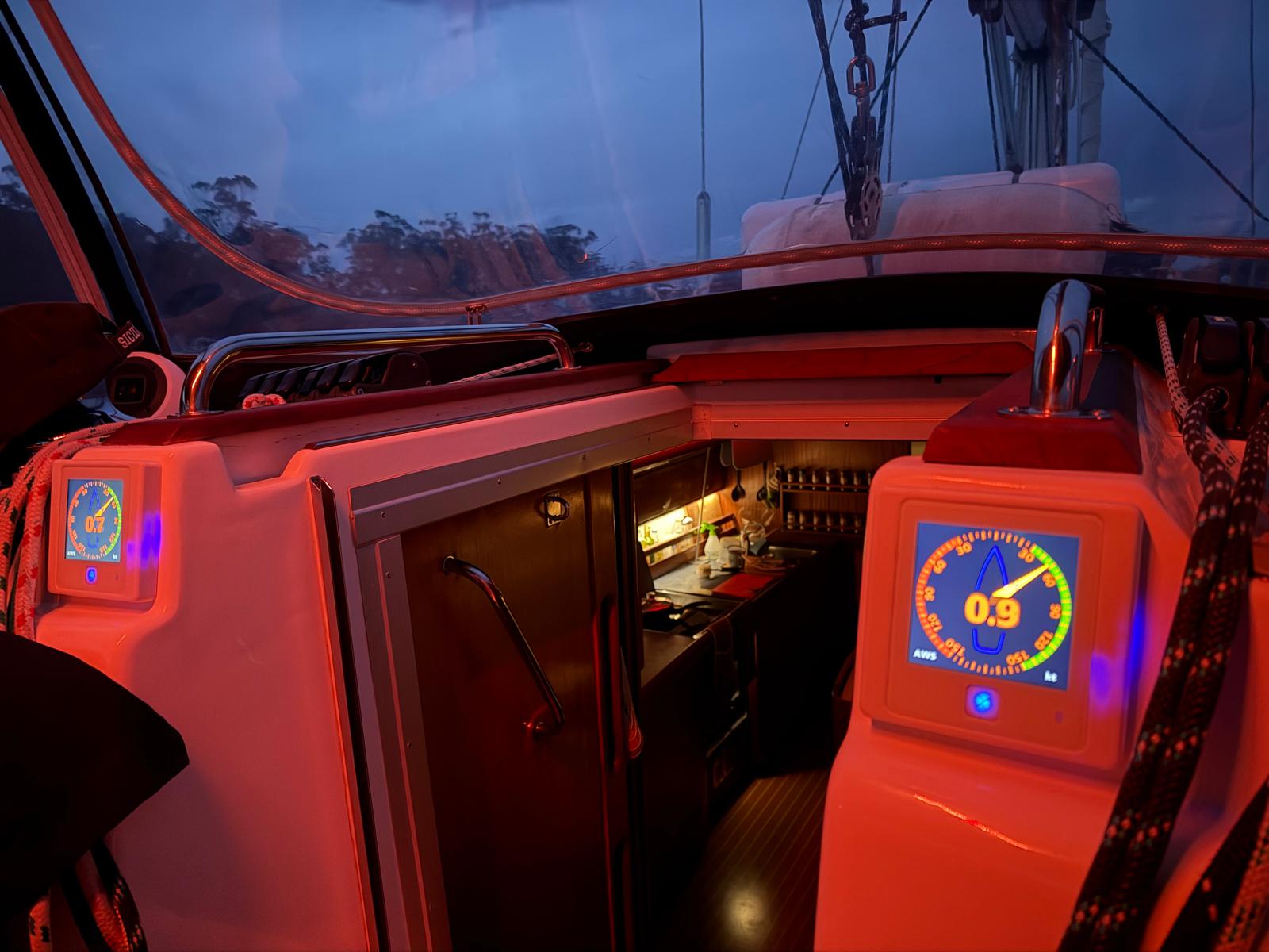
Not a lot of wind. As such.

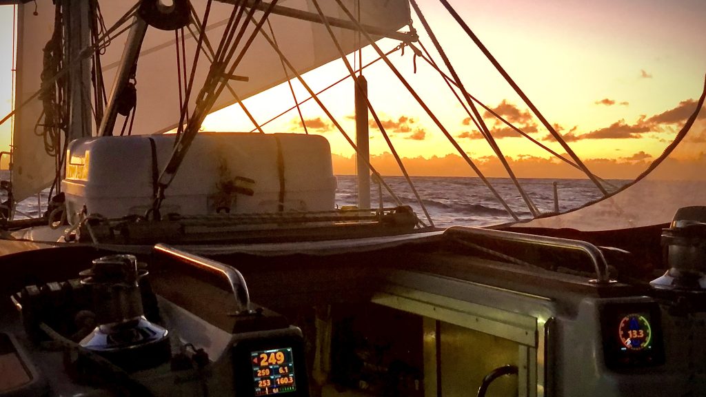
Six weeks at anchor is a hopeless place to test a wind instrument and a very good place to test everything else about it. Daylight legibility. What it draws over 40 nights. Whether it still reads true after that much dew. Whether the night theme works at three in the morning when you are up checking the anchor.
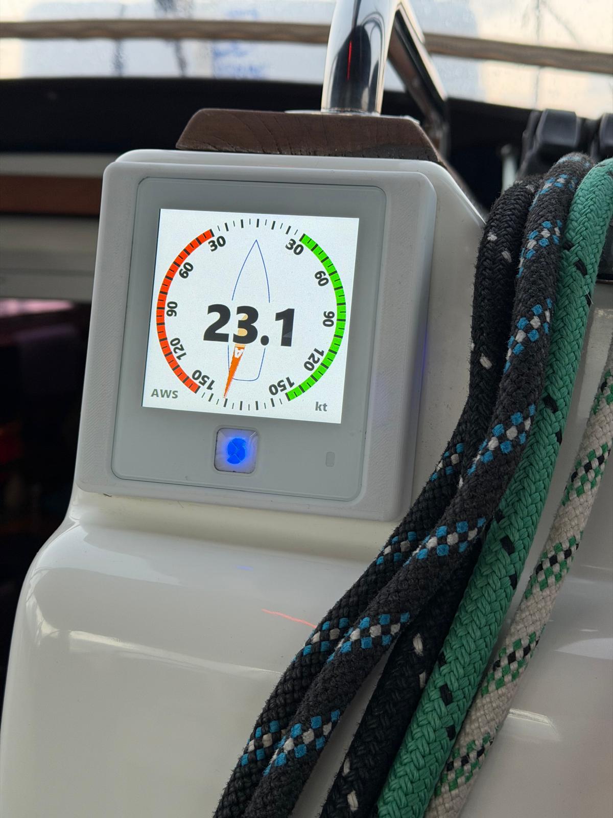
23.1 knots apparent.

The bow roller

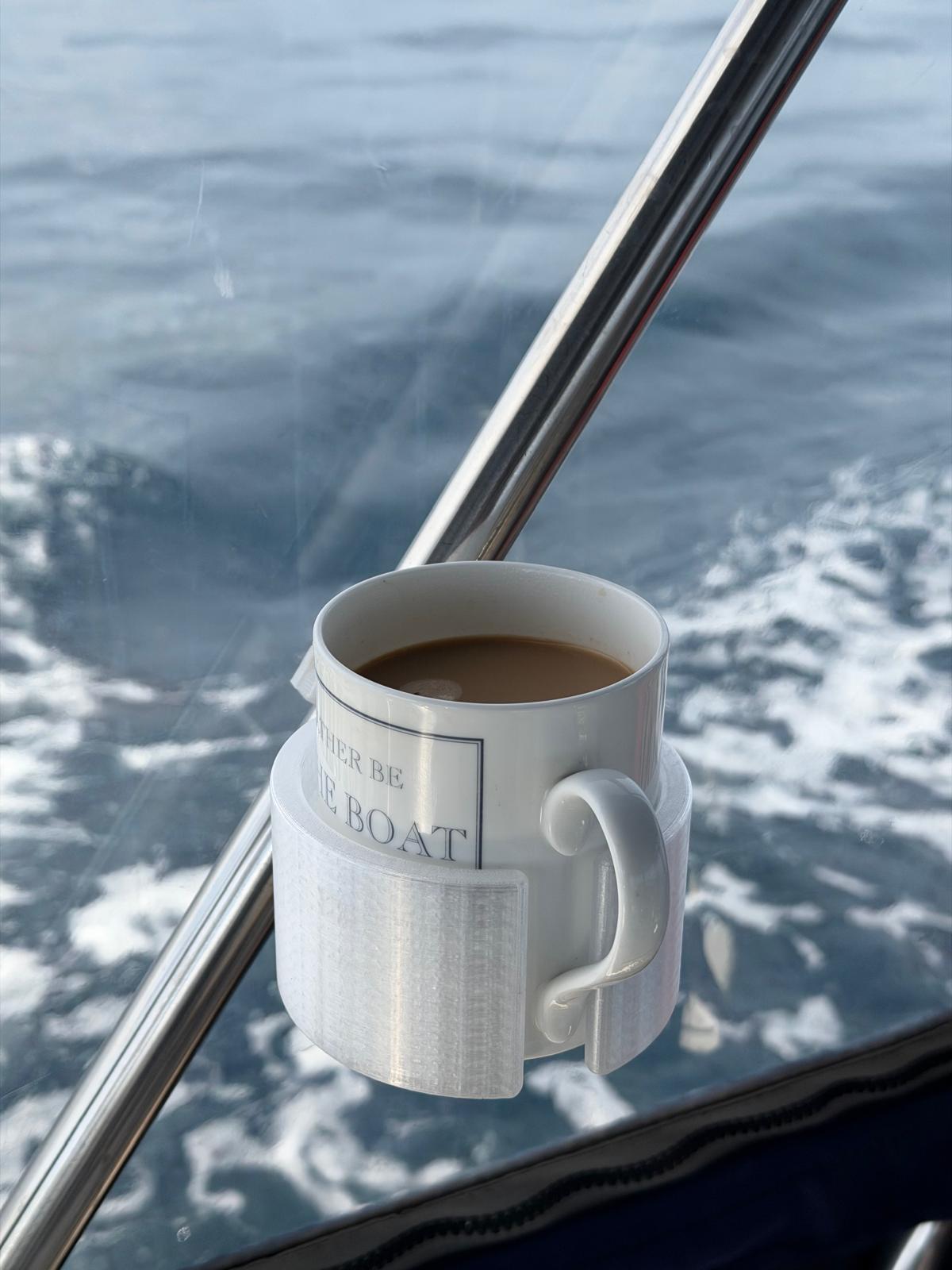
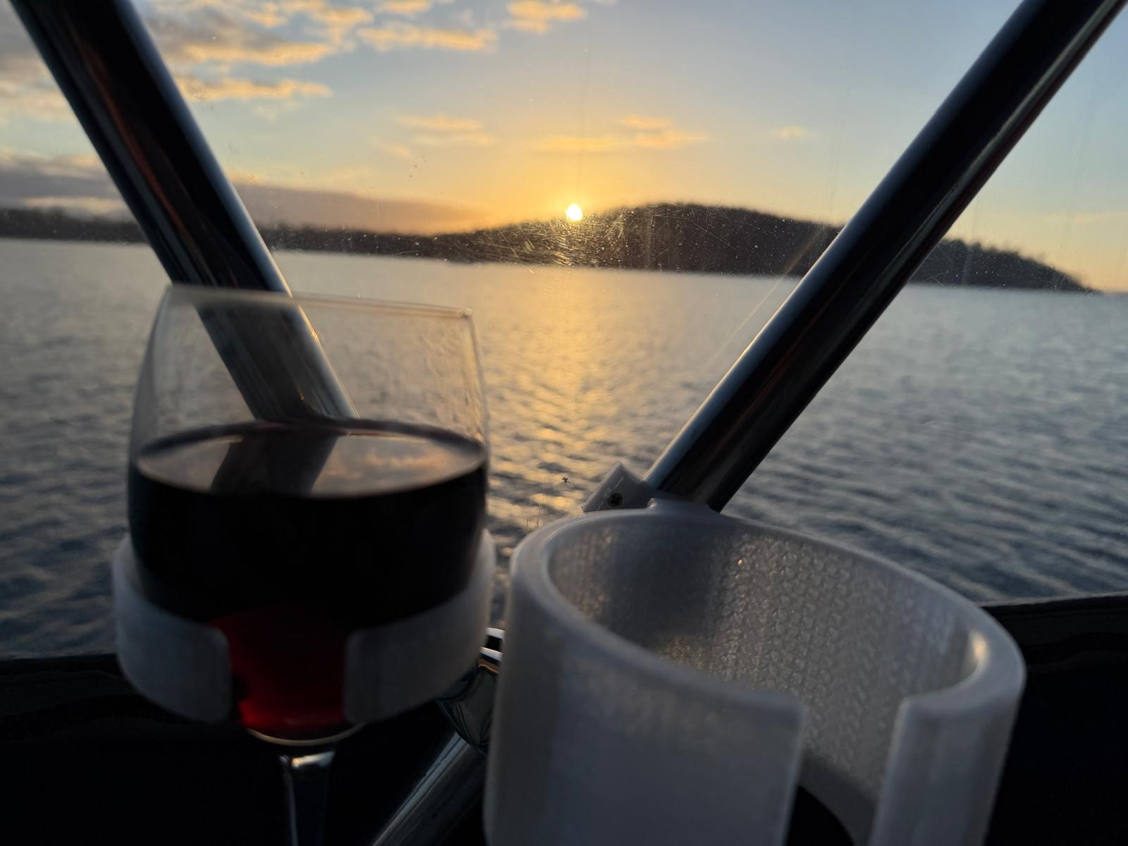
I did a lot of 3D printing during the five months on the hard. Bow roller, engine panel, hatch hinge covers, rigging screw covers, a Navpod base, and the holders that keep a wine glass and a coffee mug upright in the cockpit.

The bow roller is a work of art and it has made the anchor chain so much smoother. It also split, at the thinnest point, layer adhesion.

So I rang home and talked Maria through slicing and printing a new one, from the foredeck, down the phone. It came out beautifully.

It is still in a locker. The old one is still functional.

The pump

The freshwater pump had been making a noise for weeks. The brrrbs had been getting more frequent, and on the fourteenth it would not stop running.

I thought there might be debris stuck in the diaphragm valves. They were clean, all eight of them, but distorted. That is end of life on that part.

I spent a morning moving the pump to the bottom of the locker so it does not have to suck the water up a metre above the tank. That worked better. Still brrb-ing occasionally. I ordered a new pump head online, express post to the marina at Oyster Cove, because the same pump is used in RVs and caravans and the parts are everywhere.

Fitted it after Maria went home. Pig of a job. No more brrbs.

Fish, salad, and a stink boat

Not all of it was work.

On the eighth I did some fishing. Caught 4 and released them again. It might have been the same one, falling for the same trick. Definition of insanity. The fish caught itself, really. I just left the plastic lure dangling about 4m down, and it is more than a decade old.

Commissioned the barbie that evening. Lamb chop, sausages and a toastie. And a large salad, of course.

A stink boat came in just before sunset, anchored a respectful 150m away, then launched a rib and started wakeboarding. They were pretty quiet after that.

The microgreens on the galley shelf kept on giving the whole six weeks.

Oyster Cove

On the thirteenth I upped anchor and went over to Oyster Cove. It was very calm, so a good day for single-handed docking, and I was getting concerned about fuel supply given developments around Iran.

140 litres in the main tank, 80 in the auxiliary. Water. The laundry is pretty good, card payment, SpeedQueen machines.

Alongside for two hours and back at anchor off North Bruny by 14:24. Then another week pottering around the top of Bruny, moving between three anchorages within a couple of miles of each other.

Company

Maria came down for a few days in the third week. We went south to Dover, then up the Huon to Cygnet for three nights, and back down to Snake Bay on the eastern side of Bruny.

The boat is a different thing with two people aboard. Anchoring stops being a routine and becomes a conversation.

Then she went home.

Dover

Seventeen nights at Dover across seven separate stays.

Most of the moving was a few hundred metres at a time around Port Esperance, chasing shelter as the wind went round. There is a corner of that bay that works for almost any direction, so when the forecast swings you lift the anchor, motor ten minutes and put it down again somewhere the night will be quiet.

Once I went up to the town jetty for water and provisions. That was the only errand the whole fortnight.

Four nights in one spot. Then five. Then two. The logbook for those weeks is nearly empty, because it records events and moving 200m to get out of a northerly does not qualify.
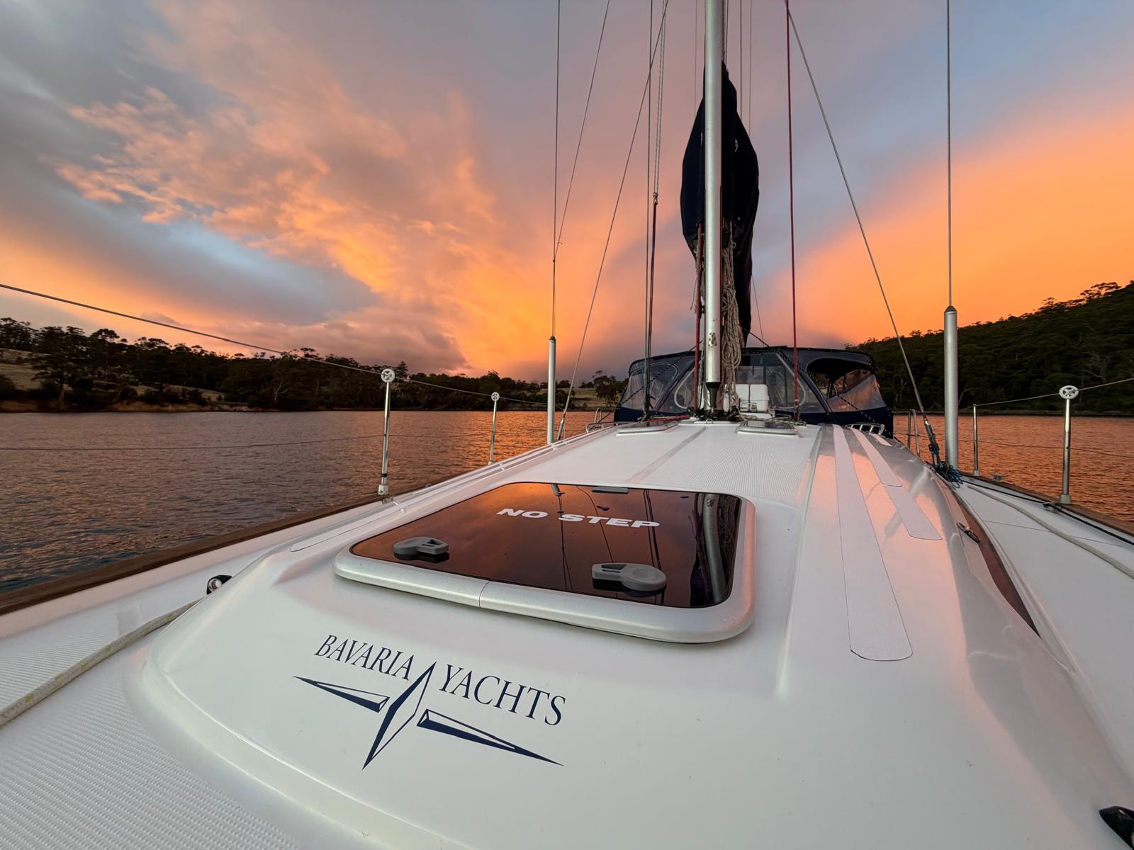
Dover.
Dover.

On the twelfth of May I went down to Mickeys Bay at the bottom of Bruny for a night, then back up to Snake Bay for three. Third visit to Snake Bay, and the plotter showed the tracks laid over each other.
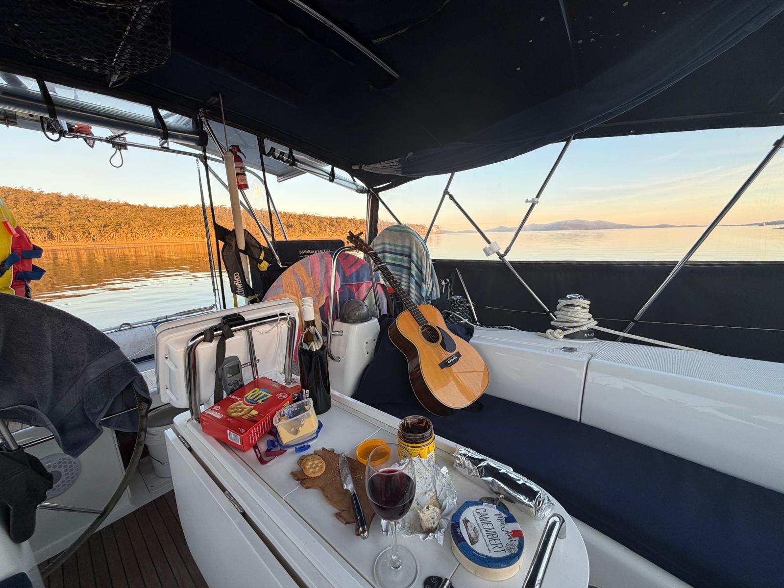
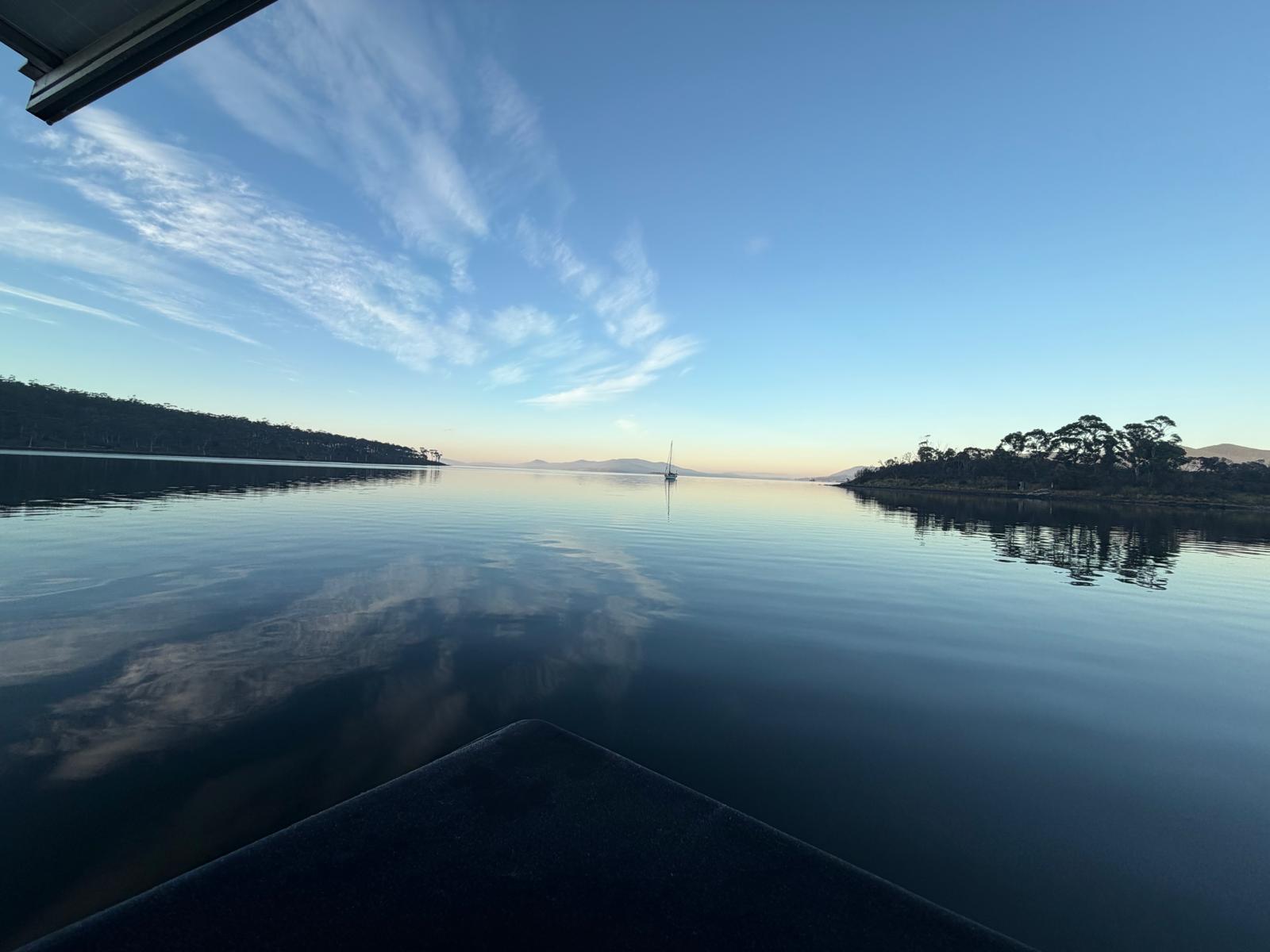
Snake Bay.
Snake Bay.
Dawn at Snake Bay, and one other boat with the same idea.

Saturday 16 May: up the Derwent

Weighed at 07:05, motored north out of Snake Bay, sails up at 10:06 for the last hour of it. Moored at Prince of Wales Bay at 12:36.

211 miles over the ground in six weeks. 51 under sail, 160 under engine. 235 through the water on the log. Forty nights at anchor.
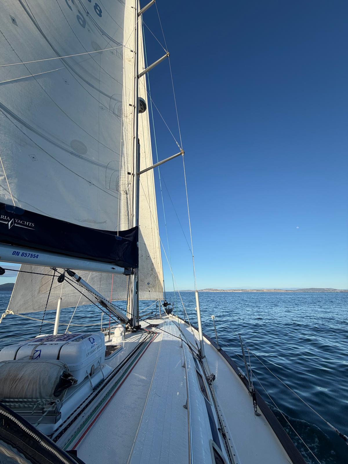
The last hour.
The last hour.

The boat

A pump head died and a printed part cracked. That is the whole list.

The anchor held every one of those forty nights, including the ones where 25 knots arrived out of nowhere off the hill, and the windlass picked it up every morning without complaint.

The instruments are prototypes, which is rather the point of taking them somewhere quiet.

*Sunny Spells is a Bavaria 44, sailed by Gerhard Malan. The marine electronics work is at scadys.io.*
Through the Denison Canal

I booked my transit of the Denison Canal for Sunday 1pm, then went through on the Saturday.

The canal at Dunalley connects Blackman Bay to Dunalley Bay and saves you the long way round the Tasman Peninsula. It was cut in 1905, it has a swing bridge carrying the Arthur Highway over it, and it operates 365 days a year, 8 to 5.

The depth

This is what kept me away from it.

MAST says “only vessels with a shallow draft should transit the Narrows and Denison Canal and only after the skipper has sought local knowledge”, and that mariners should “navigate only at high tide and in daylight hours”. There is a link to a chartlet showing a minimum depth of 1.7m, referenced to chart datum, with the caveat that conditions continually change and the depths you experience may differ. Typical daytime high tide around there is about 0.7m.

You see my problem.

So I phoned and spoke to my new mate Chris, who is the head honcho of the canal. I kept him busy with questions for almost an hour.

Short story is that 2m is probably the average draft of boats that go through, and it can comfortably accommodate 2.7m. He has been doing the job 20 years. He is also a keen yachtie, which helps, because he answers the question you are actually asking.

He also, politely, established that I had not read the MAST information properly. It is by far the most detailed and up to date source there is. They did the surveys in December 2025 and there is a chart with depths plus a downloadable gpx track. A fair bit of my hour with Chris went on questions I could have looked up.

The tide, which is the odd bit

The information describes the tide times as “ebb flow starts 2 hours 16 minutes after high tide in Hobart”, when all the tide stations around there are pretty much the same time as Hobart.

It is not a misprint.

Tides inside Blackman Bay keep rising because water runs in from both ends through narrow openings. It keeps going up until 2 hours after high tide everywhere else. The high tide inside is typically a metre higher than Hobart, because of the extended inflow.

A metre is a lot when the charted minimum is 1.7.

High tide in Hobart on the Sunday was 11AM, and he booked me for 1pm. Otherwise you fight the incoming tide. That is 20 years of doing it.

I also asked him about anchoring. No problem to anchor at Dunalley.

There is no fee. And you are not allowed to hand them a beer anymore.

The Marion Narrows

You get into Blackman Bay through the Marion Narrows.

Basically you have 2 hours of flood from the narrows to Dunalley. Minimum depth is 1.4m LAT. Best not to arrive in a strong NE breeze with an ebb tide.

Saturday

Cast off the MAST mooring at Orford at 08:29 and had the sails up by 08:45, reaching down Mercury Passage in a light nor’wester.

By 12:41 I was in the Marion Narrows and thought I might go through today. Jack was on the bridge. He was making his way back into the office and was going to call me, and I reckoned I would be going through in the next 15 or 20 minutes with a bit of luck.

Excited? Errrmmm. Sort of. Maybe more apprehensive than excited, but nonetheless.

Cleared to go at 13:34.

It was as easy as Chris predicted

Never saw less than 3m of water and 0.5kt of current with me the whole way.

There was a seal waving me through right before the bridge.

Like the Suez Canal, just shorter and narrower.

It gave me great satisfaction to cause an Easter lunchtime traffic jam in Dunalley. Cars backed up either side of the bridge. I have been on the road side of that bridge exactly once, and it was not at Easter, so it seems only fair.

Lime Bay

Out the other side, down into Norfolk Bay, anchor down at Lime Bay at 14:58. Seabird was already there.

What a nice anchorage.

Next morning I weighed at 06:51, out past the Iron Pot and south-west into the D’Entrecasteaux Channel. I was planning on two nights.

If you are thinking about it

Ring Chris. Read the MAST page first, so you waste less of his time than I wasted of it. Take the slot he gives you rather than the one you think you want, because the tide inside Blackman Bay does not behave the way the tables suggest.

And stop worrying about the depth.

*Sunny Spells is a Bavaria 44, sailed by Gerhard Malan. The marine electronics work is at scadys.io.*
Down the east coast, single-handed

I left Beauty Point on Sunday 29 March, five months after Sunny Spells went up on the hard at the TYC slipyard. It was getting late in the season for the east coast, but a window opened so I took it.

Beauty Point, Tomahawk, St Helens, Coles Bay, Orford, then the canal at Dunalley and into the Channel. Four days of sailing, three nights waiting on a bridge, 264 miles.

The tides were perfect for it. Full moon springs, with high water early morning and again in the evening, bookending each day. That matters for Georges Bay, where you want all the water you can get over the bar. By the time I reached Dunalley a week later high tide had moved to the early afternoon, which suited the canal run exactly. I did not plan any of that.

Sunday: Beauty Point to Tomahawk Island

Out of the Tamar and east along the north coast. Long stretches under engine, so I went round the boat with the Teflon spray and did every block, car and sheave I could reach.

Some jobs cannot be rushed.

Once the flood started the head current was 2 knots. Fortunately by that stage it was blowing 20 knots from behind, so 9 knots boat speed was still 7 over the ground.

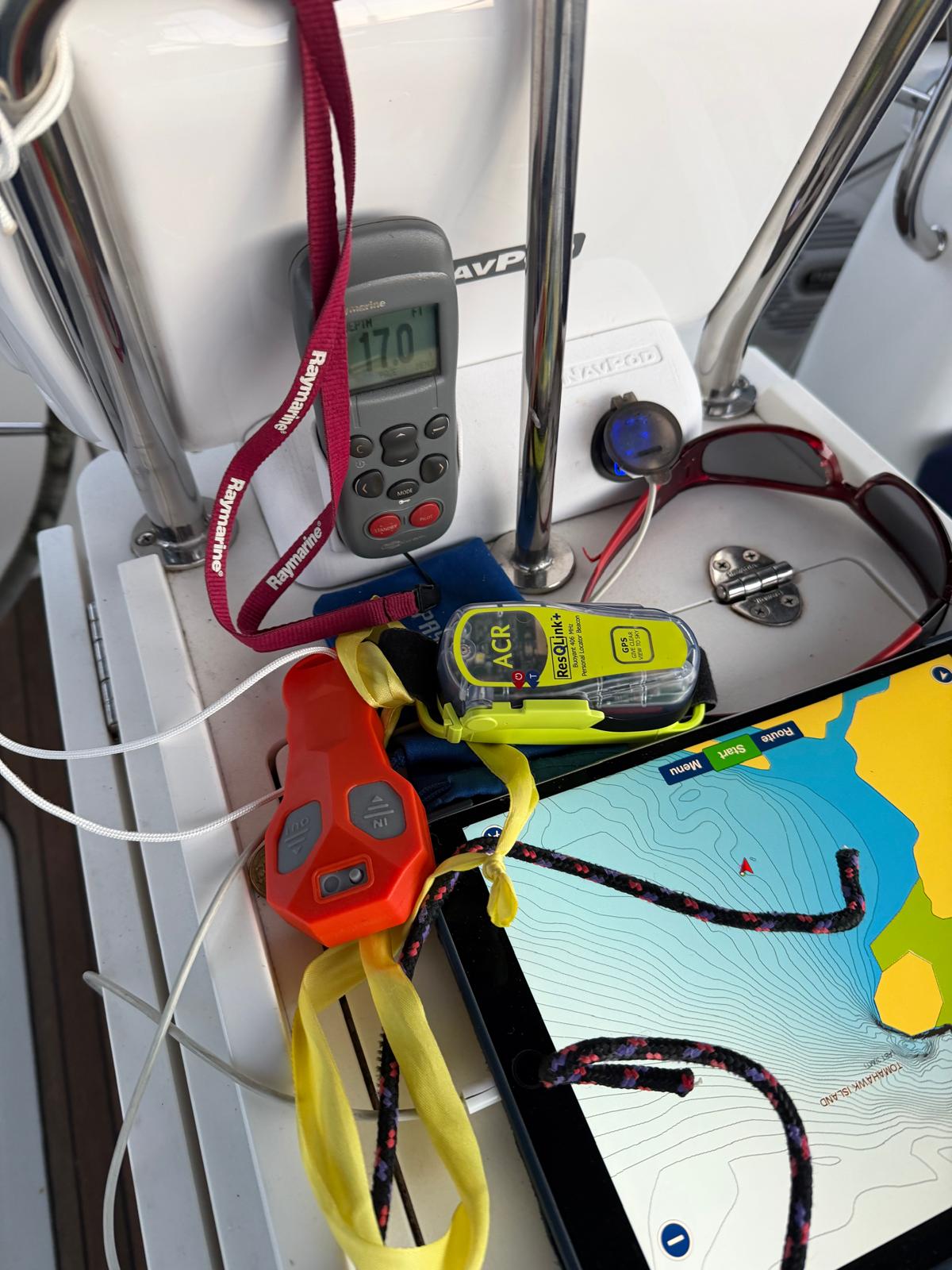
The new wireless windlass remote went in during the refit, so I could anchor without walking back and forth a dozen times. It worked very well. I still missed my anchor crew. 5m of water, 40m of chain. I was going to put out 30, but I miscounted the markers, which alternate at 90 degrees and take some getting used to.

Tomahawk was a great tip. It was blowing 20 knots where I dropped the main, and less than 8 in the anchorage with just the slightest swell coming round the island.

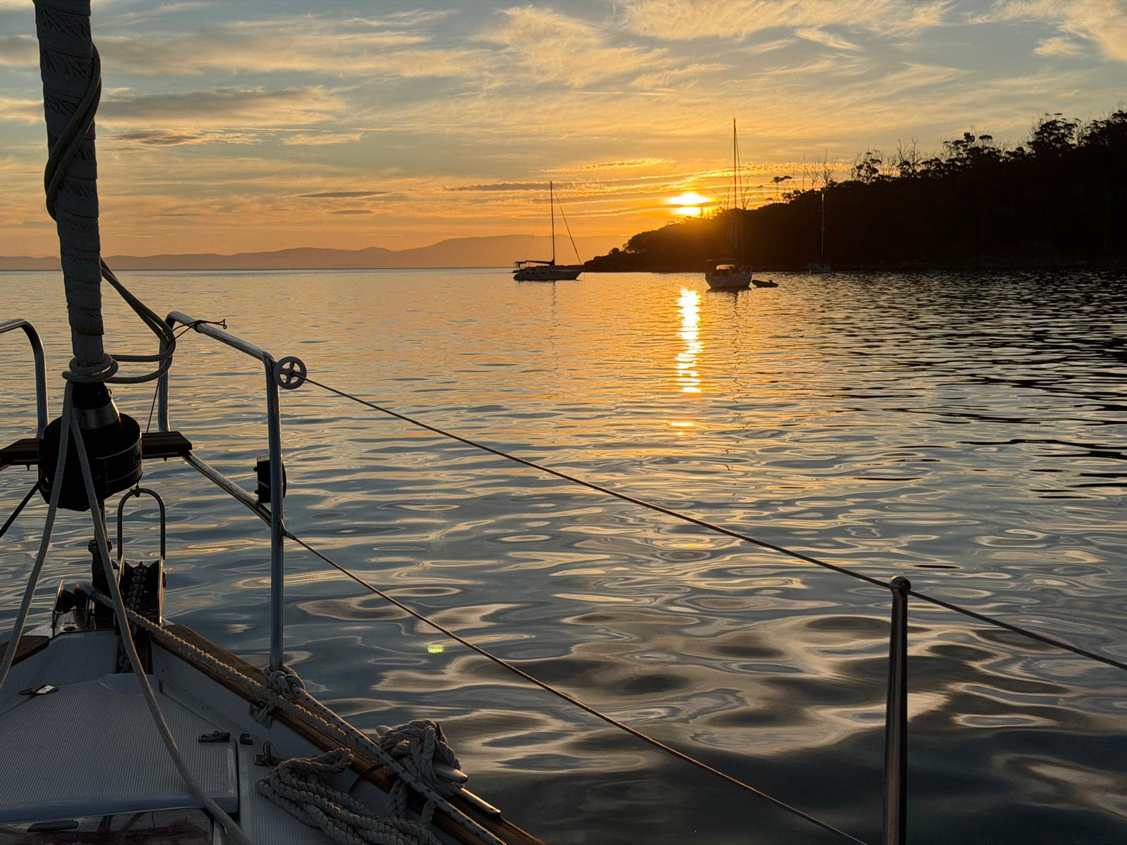
First night at anchor.
Sundowner.
Sundowner.
When too many lanyards is barely enough.

The question tormenting all of Tomahawk that evening was whether I would jump into the 18 degree water for my shower. I did.

Monday: Tomahawk to St Helens

Weighed at 07:47 and motored east in nothing much.

Just as I passed Eddystone the wind went up to 18-25 knots and looked like it was going to stay there. Two reefs plus 75% genoa and still doing 8 knots. It was a little hectic turning into 25 knots on my own to get the main down. Trip max of 12 knots boat speed just before I reefed, which tells you I left it a bit late. The reefing cars were smooth as strawberry wine. That’s the Teflon.

Round the corner the wind dropped back to 12-18 and we settled into a 6 knot average, ETA 16:30.

Chatted with VMR St Helens on the way in. Young South African chap on the radio, which I was not expecting…

The bar was fine this time.

Then I promptly ran aground looking for the first anchoring spot. Slowly, because it looked shallow. Looks like they dumped the dredger spoil there. Mystery solved a minute later when I remembered the depth is shown below the transducer, not the keel. I ran aground at 1.2m.

Further in it’s lovely. Went over the side for a snorkel on the prop, which had been vibrating since somewhere near Swan Island. There was tons of kelp in the water through that passage. Well and truly wrapped around the hub, and a huge forest of it at the top of the rudder. There’s 1.2 knots of current running through there, so I had to paddle flat out just to get from the transom to the sail drive.

That was quite a lot of kelp. Same bay, sixteen years apart.

The last time I crossed that bar

February 2010, single-handing a 1982 Carter 33. An IOR three-quarter tonner, which is a boat designed to go round buoys rather than to be pointed at breaking water by a tired man.

I called Tamar Sea Rescue that morning to ask about the state of the bar, keeping Flinders Island as an option if it was impassable. They called St Helens, who said they would not give instructions but would send a rescue boat out to lead me across.

I felt reasonably comfortable about it as the day went on, having done several bar crossings in the previous couple of years, some in breaking surf. By 1500 it was blowing 25 knots from the north-east directly onto the bar and I was dog tired. They had also said they would inspect the bar and only take me through if conditions were safe, and the chances of that were going down with the rising wind. I could not bear the thought of another 10 hours sailing in the dark to get to Wineglass Bay.

The rescue RIB came out within minutes of my arrival in Georges Bay and they were not happy. The tide was late, still rising, and the bar was breaking in a mass of white water.

What I remember saying on the radio, more or less, was “if I get thrown on my beam ends and I’m in the water, will you come and get me?” The answer was “yes, of course”, to which my reply was “I’m coming in!”

We agreed I would cross at my own risk. Sails down, lifejacket on, boat closed up in case we got swamped or rolled. Then going for the bar I felt a lot of vibration and realised I’d picked up kelp on the prop. Stopped the engine, put her in reverse to fold the prop, restarted, gunned her astern and felt the familiar smooth running. Then full throttle behind the rescue boat. I only surfed down one breaking wave and then we were in the calm water of the river, bumping past Pelican Point in slightly less than 6ft, following them the whole way.

I wrote it up at the time, here.

They are volunteers and entirely self-funded. Chatting to Ian Hollingsworth at the base afterwards I was amazed to learn they help around 100 boats a year, two or three a week, sometimes towing from over 100 miles out.

I stayed a week that time, moored to the jetty, drinking with other boaties in the evenings and chatting to Ian during the day. Fond memories. That’s how I ended up running their website, which I have done ever since.

Tuesday: St Helens to Coles Bay

One of the quietest nights ever. Wind was zero knots when I went to bed around 22:00 and the boat did not rock in the slightest. Glad I went that far up Georges Bay.

Woken at 05:00 by wind howling through the rigging. 15-20 knots easterly. Not even the detailed 2 day BOM model had shown it. By 07:00 it was down to the forecast 5 knots NW, and by breakfast I had 3-4 knots TWS.

Sailed for about 20 minutes when I had 8 knots on the beam from the west, a land breeze. After that full main and about 33% of the #2 genoa, motor-sailing at 6.7 knots. Very flat, just the long period SE groundswell and even that less than a metre.

Through the Schouten Passage around 18:00 and anchored at Bryans Beach by sunset, under the Hazards, two other boats already in.

Bryans Beach.
Bryans Beach.

Wednesday to Saturday: Orford

Poked up Spring Bay towards Triabunna first to have a look, then took one of the three MAST moorings off Shelley Beach.

Three nights there, waiting for a window through the Denison Canal.

The change, when it came, was quite violent. Went from nothing to 30 knot westerly gusts in minutes with heavy rain, lasted about 30 minutes, then slowly cleared. Then it was very nice again.

One of the boats anchored on the other side came in eventually. Heather Anne, I think. They took another of the MAST moorings. Still one empty. Then there’s half a dozen boats on private moorings, and two or three dozen empty or abandoned ones.

Maria was watching me on MarineTraffic from home and reported a veritable convoy of boats leaving Hobart on the Friday, heading for the D’Entrecasteaux Channel. Easter, I guess.

I spent the time on the phone to the canal and reading the MAST information properly. That has its own post.

Easter Saturday: the canal, and Lime Bay

Cast off at 08:29 and had the sails up by 08:45 in a light nor’wester down Mercury Passage.

I was booked for the Sunday but the tide looked right on the Saturday, so I went through a day early. Anchor down at Lime Bay at 14:58. Seabird was already there.

Next morning I weighed at 06:51, out past the Iron Pot and south-west into the D’Entrecasteaux Channel. Anchor down in the Duck Pond at the top of Bruny by midday. I was planning on two nights.

The numbers

264 miles over the ground from Beauty Point to the far side of the canal. 131 under sail, 133 under engine. Best of 9.8 knots SOG.

The six weeks in the Channel that followed ran 51 miles of sail to 160 of engine, which is a different kind of sailing altogether.

On going alone

The sailing is not the hard part. The hard part is that everything which used to be two jobs at once now happens one after the other. You reef while the boat looks after herself. You anchor with a remote in one hand and nobody counting chain at the bow. You go over the side into a knot of current to clear a prop with nobody on deck, and that last one is worth thinking about properly beforehand.

It all takes about three times as long, and you plan it or you do not do it.

*Sunny Spells is a Bavaria 44, sailed by Gerhard Malan. The marine electronics work is at scadys.io.*
Nouméa to Bundaberg

Départ

As a consequence of a fortunate bureaucratic arrangement we were required to complete checkout formalities on Friday before 11AM if we wanted to leave on the weekend. We then had until early Monday to leave, giving us maximum flexibility. Checkout was tedious and took 3 hours, but every official we dealt with was friendly and helpful.

Back at the boat, we transferred 7 of 8 jerry cans of diesel into the tanks, leaving us with 400 litres in the tanks and a 20 litre “reserve of last resort” (7 hours motoring) in the remaining jerry can. We then cast off and motored into the 25 knot southerly and waves to Baie Saint Marie where we anchored to scrub the slime and algae off the hull.

All in all not an idyllic day of cruising.

This morning we weighed anchor around 8:45AM and were underway by 9, motoring south into wind and waves towards Ïlot Amadee and Passe Boulari.

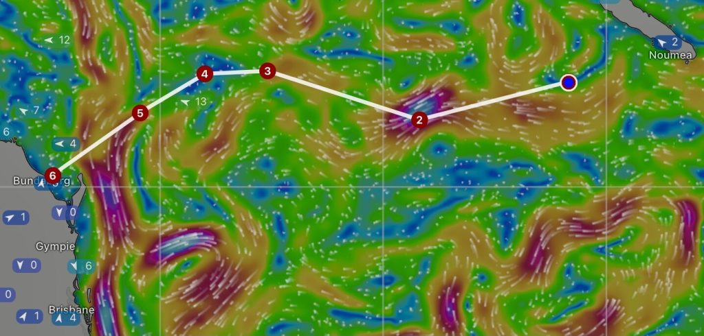
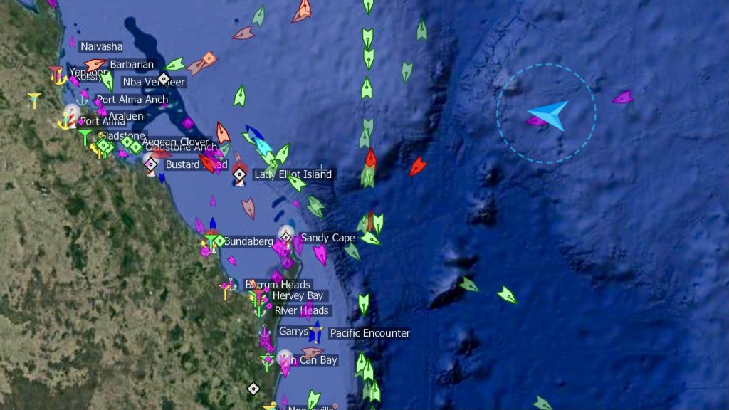
We have 800 miles to go to Bundaberg with mostly moderate easterlies and a west setting current to take us there. We are heading for the channel through the sea mounds south of Chesterfield Reef, almost exactly at the halfway mark. We intend to transit this obstacle between the Argo Bank and the Kelso Bank, a channel about 18 miles wide between the 2000 meter countours. We will then curve northward to follow the currents and give us fair bit of northing to play with once the south setting Australian East Coast Current starts trying to sweep us down the coast. The screenshot of the ECMWF surface current forecast from Windy is shown below. It’s complicated…

With five to seven days between southerly changes in the Tasman Sea, we have our work cut out to make it into Bundaberg before the next southerly froths up that south-setting current. We hope to be inside the river by 2AM Friday morning.

We motored the first 4 hours into the fresh southerly breeze and waves, and it was slow going, making around 4 knots. Once outside the pass we turned west and set the small genoa and staysail on their poles for our preferred downwind sail plan.

The wind was fresh all day and through the night, gusting 30 knots. We only had about 30% of the genoa rolled out, yet we regularly saw the speed over the ground go up to the low 9 knots.

Day 1

It was gusting up to 25 knots at times in the early hours and the sea state was quite rolly, so we kept the reduced sail until it got light and the wind was a steady 10 to 15 knots. Shortly after the rest of the genoa was unfurled, the wind freshened a bit to around 15 to 18 knots average. The wind is pretty steady and the sea state much more comfortable than yesterday, so we are making a good pace (7.3 knots average in the last half hour) directly toward the waypoint south of Argo Bank.

The ECMWF weather model now shows a strong southerly change in our route area late Thursday, so we may well still get caught out at sea in the proverbial washing machine around Sandy Cape. The other models still forecast the associated low-pressure system to peter out well to the south of us without impacting our passage, so we prefer to believe those! Not much we can do other than keep the pace up in an effort to beat the weather. For the moment, conditions could not be better, and we are comfortably winning the race with our PredictWind routing.

In the meantime, our days are consumed with preparing for re-entry into Australia, an exercise that promises to be the most painful and costly check-in of our entire circumnavigation. We have now decided to engage a shipping agent to handle the re-importation of Sunny Spells into Australia as horror stories abound of people getting it wrong, and mistakes can be very costly. As Roy Steyn said to me 44 years ago when I fitted every single one of the Ford Capri’s crankshaft bearings the wrong way round: “ah yes, do it yourself Gerhard, it’s not a lot more expensive! Lesson learned, thanks Roy!

Monday

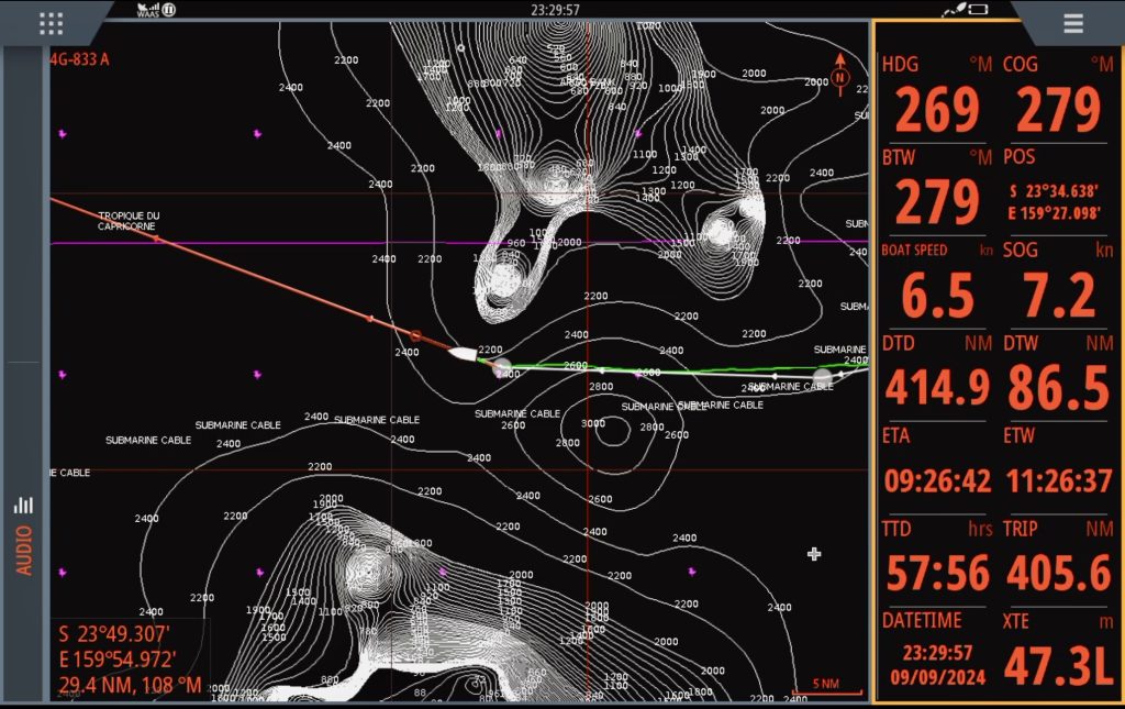
We cleared the southern end of the Argo Bank and were now heading NE to position ourselves for the crossing of the Australian East Coast Current on Wednesday.

We are now halfway to Bundaberg, still motoring in around 8 knots of SE wind on a pretty flat sea. The current petered out as we approached the sea mounds, so our SOG has dropped to about 6 knots average. We are now waiting for the breeze to pick up, having swapped the two headsails and their poles this afternoon to set up for a starboard tack to the next waypoint.

In the latest forecast the GFS has now changed significantly and is consistent with the ECMWF, showing a strong southerly change on Friday morning. With current progress we are hoping to be safe inside Port Bundaberg by midnight Thursday. With a little luck we will be spared an unpleasant end to our circumnavigation.

Tuesday / Wednesday

We motored until 3:30AM on Tuesday, when the breeze picked up just enough to allow us to make 5.8 knots.

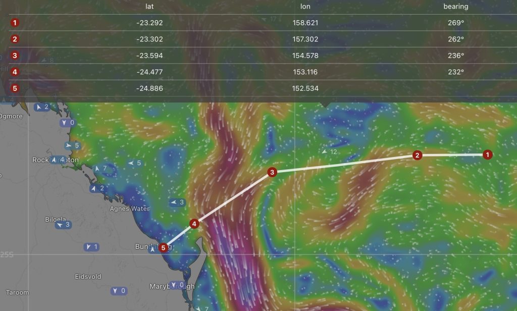
The currents had migrated a little with the most recent forecast, allowing us a bit more direct route to Hervey Bay.

It turned into slow day of hard yakka to eke out every last fraction of a knot of speed that we could, with little wind and at least half a knot of adverse current. Clearly, we’ve been spoilt by the conditions up to the halfway mark, but motor sailing and making 4.5 knots when we need to average 5.8 was not fun.

We swapped the two poles again so the sail plan is set for the port tack which should take us into the East Coast Current and then towards Sandy Cape.

The breeze slowly returned late on Tuesday, with the current is clocking around aft of the beam as well, so our speed picked up to the mid sixes.

The day’s run on Wednesday morning of 134 miles was not too bad given the conditions, and we needed to average under 5 knots to get in before the southerly change (earliest forecast now 7AM Friday) – doable, wind and current willing.

Tuesday / Wednesday

For our last night at sea we were blessed with idyllic conditions. The sea state was superb, with a longish 1.5m swell from behind – hardly any roll, just a gentle rhythm. We had about a knot of current with us and around 20 knots steady SE breeze to hustle us along at better than 7 knots. The combination of sea, current and wind created a sense of effortlessness, as if the boat has become super slippery.

We crossed the river of shipping between China and the major Australian ports of Brisbane Newcastle, Sydney and Melbourne in the early hours of this morning and crossed our outbound track (June 2019), about 10 miles offshore from Bundaberg.

The ship’s clock was set to AEST (UTC +10] this morning and we had 65 miles to go until we dropped anchor.

Our detour north paid dividends throughout the night as we entered the Australian East Coast Current, following its curve north of Fraser Island. The current, fair wind and benign sea state allowed us to keep the pace up above 7 knots until the wind started abating in the early hours. At 5AM we had to douse all sail as they were just flapping and we started motoring for home. We had 1.5 knots of current going our way, as we hitched a ride on the flood tide into Hervey Bay.

We spent tidying away sails, cleaning the cabin and rinsing the salt off the boat, getting her all Bristol for clearing in on Friday.